GPS and satellite technology have given agriculture a big gift, one that keeps on giving. With precision farming, growers now plant and fertilize based on field data and guidance systems calibrated to deliver the right input to the right locations. Productivity increases faster than costs, or at least that’s the goal.
Even a decade ago, there were only so many satellites and they were expensive to access the data for personal use. But now, nanosatellites scarcely bigger than a lunch pail provide far greater coverage at a fraction of the cost. Their low orbits and high resolution cameras give accurate, full time coverage. More importantly, the type of data available allows for greater application of data synthesized from aerial and ground sources.

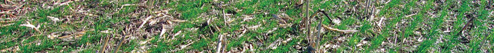
Remote sensing is able to detect variability in soil and crop conditions.High-resolution, “multi-spectral” photos help understand what’s going on in the fields, and help reduce crop inputs. Pest and weed control are easier and less expensive. Imagery and field data help growers schedule harvest to maximize yields.
The latest in a new array of these tools is a collaborative effort called OpTIS (Operational Tillage Information System). Combining satellite and various on-the-ground data gathering methods, growers can now access information that allows field-specific tracking of crop residue management, types of tillage and cover crop use and value.
OpTIS uses multi-spectral satellite imagery to measure wintertime vegetation on agricultural fields and combines this information with site-specific knowledge of crop rotations and cover crop management practices. Images taken throughout the year are converted to show estimated cover crop coverage, the amount of cover crop residue, the type or classification of tillage practice, monitoring seasonal changes in cover crop residue and compiling all this with data from the field, the watershed and the wider county level.
According to a presentation by Applied GeoSolutions, LLC, about the OpTIS system, “Proximal sensors and on-farm sampling are used to calibrate imagery interpretation, and hyper-spectral, biophysical models are used to understand the impact of various components of ground cover (vegetation, soils, crop residue, and shadow) on field reflectance. Using these methods, USGS researchers can map cover crop performance at the watershed scale and improve the understanding of conservation outcomes associated with various cover crop management strategies. This information is used by farmers and conservation agencies to promote adaptive management of winter cover crop programs to maximize environmental benefits.”
In a pilot program last year, OpTIS was used in a small number of Indiana watersheds. Based on initial feedback, the program will broaden this season to more sites in that state as well as other sites in Ohio, Illinois, and Iowa, according to Dan Towery, whose work with the Indiana Soil Health Management project intersects with the OrTIS project.
Towery also said that the data available will help growers understand more about their varied soil types, help them gauge the impact of cover crops on building organic matter in the soil, and even better understand how to adjust management practices more accurately based on annual precipitation.